
Sela Pass and Sela Tunnel: Altitude, Snow and Permits
Sela Pass guide: 4,170 m altitude, the Sela Tunnel opened in March 2024, snow months, the frozen lake, permits, altitude safety and the old summit road.
Shillong Trip Travel Desk · Updated · 9 min read
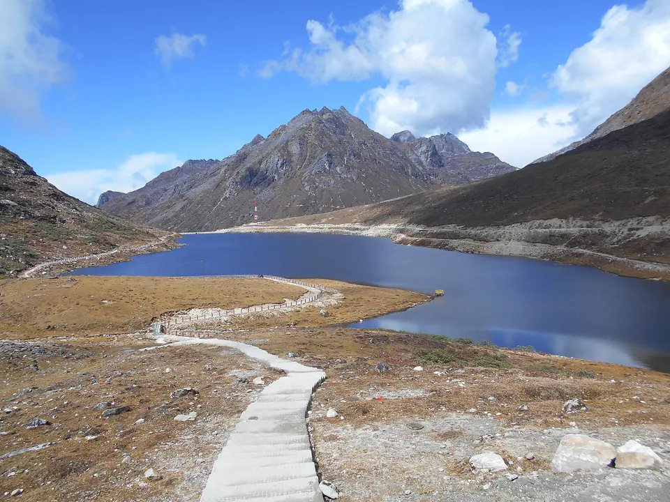 Itrajib · Commons · CC BY-SA 4.0
Sela Pass is a 4,170-metre (13,700 ft) high-altitude pass on the Dirang–Tawang road in Arunachal Pradesh, with a sacred lake that freezes in winter. Since March 2024 the Sela Tunnel lets traffic bypass the summit, but the old road still reaches the pass in fair weather. Snow usually lies from December to March; Indians need an Arunachal ILP.
Key takeaways
- Sela Pass sits at about 4,170 m on NH-13, roughly 78 km before Tawang, and is the highest point most Tawang travellers reach.
- The Sela Tunnel, opened on 9 March 2024, runs below the summit at about 13,000 ft, saving about 10 km and an hour between Dirang and Tawang.
- The tunnel does not replace the pass as a sight: ask your driver to take the old road over the top when the weather is clear.
- Expect snow from December to March and sometimes in November and April; the lake is often frozen in January and February.
- Stop for 20–40 minutes at most if you have come up from Dirang at about 1,500 m, and move slowly at the top.
- No separate permit covers Sela itself, but Indians need an Arunachal ILP and foreign nationals a Protected Area Permit to be on the road at all.
On this page 14 sections
- Sela Pass at a glance
- Where Sela sits on the Tawang road
- The Sela Tunnel and what it changed
- Tunnel or summit: how to choose
- Sela Lake and the view from the top
- Month by month at Sela
- Driving Sela in snow
- Photographing Sela
- Altitude: how to stay comfortable
- Permits for the Sela road
- The stops between Sela and Tawang
- Where to stay either side
- What to wear and carry
- How we'd plan it
- FAQs
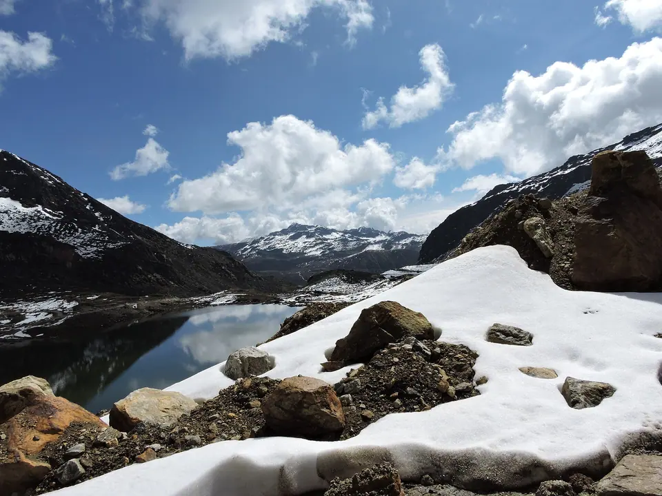
At the top of Sela, the car door is the hardest part. You open it at 4,170 metres to a wind that cuts straight through a fleece, prayer flags cracking over a gate arch, and a lake below the road that in January is a white sheet of ice. Five minutes later everyone is back in the car with red cheeks and a phone full of photographs.
Since March 2024, many travellers never see any of it, because the Sela Tunnel now takes the traffic under the summit. This guide explains what Sela is, how the tunnel changed the drive, when to go for snow or clear views, and how to make sure your driver takes you over the top.
Sela Pass at a glance
| Fact | Detail |
|---|---|
| Altitude | About 4,170 m (13,700 ft) |
| Road | NH-13, between Dirang (West Kameng) and Tawang |
| From Tawang | Roughly 78 km, 2.5–3 hours |
| From Dirang | Roughly 60 km, 2–2.5 hours |
| Sela Lake | About 4,160 m, often frozen in January and February |
| Snow season | Usually December to March |
| Permit | Arunachal ILP (Indians), PAP (foreign nationals) |
| Tunnel | Sela Tunnel, opened 9 March 2024 |
Road distances vary slightly between maps and with the tunnel or summit route.
Where Sela sits on the Tawang road
Anyone driving to Tawang from Assam follows NH-13: Tezpur, the Bhalukpong check gate, Bomdila, Dirang, then up over Sela and down to Jang and Tawang. The Bomdila to Tawang stretch alone is about 171 km.
Sela is the high point of that journey. The road climbs from Dirang's apple orchards and kiwi farms at about 1,500 metres, through rhododendron and fir forest, to bare, windswept slopes above the tree line. Then it drops toward the Tawang valley past the Jaswantgarh war memorial and Nuranang Falls near Jang.
For the full drive from Guwahati, including where to break the journey, see our Guwahati to Tawang by road guide.
The Sela Tunnel and what it changed
Before 2024, Sela was the weak link on the Tawang road. Heavy snow could shut it for days, cutting Tawang off from the rest of India at the height of winter.
The Sela Tunnel was built to fix that. Key facts:
- Opened: inaugurated by the Prime Minister on 9 March 2024
- Built by: the Border Roads Organisation, under Project Vartak
- Layout: two tunnels, about 475 m and about 1.8 km long, with roughly 12 km of approach roads in total
- Height: at about 13,000 ft, several hundred metres below the summit
- Savings: about 10 km of distance and about an hour of driving between Dirang and Tawang
For travellers, the tunnel means Tawang is now reachable through most of the winter, which has made January and February trips far more reliable than they used to be. Snow and landslides can still cause delays on the approach roads, so check current status before you travel.
Tunnel or summit: how to choose
The old road over the pass has not been closed. In clear weather, it remains the way to see the lake, the gate and the view. Many drivers, though, now take the tunnel by default to save time.
| Via the Sela Tunnel | Over Sela Pass | |
|---|---|---|
| Highest point | About 13,000 ft | About 13,700 ft |
| Time, Dirang–Tawang | About 1 hour less | Longer, plus stop time |
| Views | Few, mostly the approach roads | Lake, gate, snowfields, peaks |
| In heavy snow | Usually open | May be closed |
| Altitude exposure | Lower and shorter | Higher, with a stop at the top |
| Best for | Bad weather, tight schedules, altitude-sensitive travellers | Clear days, first-time visitors |
Our rule: if the sky is clear and the summit road is open, go over the top on the way to Tawang, when you are fresh and the morning light is good. Take the tunnel on the way back if time or weather is short. Tell your driver the night before.
Sela Lake and the view from the top
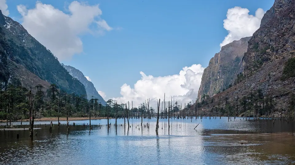
Sela Lake lies just below the pass on the Tawang side, at about 4,160 metres. It is one of many high lakes in this area that Tibetan Buddhists consider sacred. In summer and autumn it is a still, dark lake ringed by rock and grass; from about December it begins to freeze, and in January and February you can often see it covered in ice and snow.
At the top you will find the gate arch, prayer flags, a few tea stalls in season and parking along the road. Do not count on food or toilets being open in deep winter.
Two respectful habits: do not walk onto the frozen lake, and do not throw coins or rubbish into it. The ice may look solid but is not always safe, and the lake is sacred to the people who live here.
Month by month at Sela
| Month | Conditions | What you see | Our view |
|---|---|---|---|
| Oct–Nov | Cold, dry, clear skies | Open lake, sharp mountain views | Best for views and photography |
| Dec | First heavy snow likely | Snow on the slopes, lake starting to freeze | Good, keep a buffer day |
| Jan–Feb | Coldest, deepest snow | Frozen lake, snowfields | Best for snow; tunnel may be needed |
| Mar | Snow persists, days warmer | Snow on the road edges and slopes | Good balance of snow and access |
| Apr–May | Snow melting, rhododendrons lower down | Patchy snow, fresh green below | Pleasant, some late falls |
| Jun–Sep | Monsoon cloud and rain | Views rare; landslides lower down | We avoid it for Sela views |
For snow, late December to February gives the best chance. For clear views of the lake and peaks, October and November are hard to beat. Our Winter Tawang and Sela Snow trip is timed for the first; the Tawang via Dirang and Sela itinerary runs through both windows.
Driving Sela in snow
Snow is the reason many people come in winter, and it is also what makes the road hard. How we handle it:
- Vehicle: an SUV with good ground clearance, such as a Scorpio, Bolero or Innova, driven by a local driver who knows the pass. We do not send hatchbacks or sedans over Sela between December and March.
- Chains and timing: drivers carry snow chains in winter. We aim to cross before noon, when the road is freshest and before afternoon cloud and wind build up.
- Clearing: the Border Roads Organisation clears the road after snowfall, but a heavy fall can hold traffic for hours. The tunnel has reduced these delays, not ended them.
- Black ice: early mornings after a clear night are the most slippery. Your driver may wait for the sun before starting the descent.
- Buffer day: from December to March, we keep one spare day in every Tawang itinerary for weather.
- Self-drive: we do not recommend driving Sela yourself in winter, even with mountain experience, because conditions change within an hour.
Check current status before you travel, and trust your driver's call on the day.
Photographing Sela
Sela is one of the most photographed places in Arunachal, and a little planning helps.
- Light: morning, before about 11 am, gives the clearest air. Cloud often builds from midday.
- Lake: the best angle is from the road just above the lake on the Tawang side. In winter the frozen surface is bright; expose for the snow.
- Batteries: cold drains them fast. Keep spares in an inside pocket.
- Drones: this is a sensitive border region with Army installations nearby. Do not fly a drone without clear, written permission.
- People: prayer flags and gates make good frames, but if monks or local families are praying, give them space.
Altitude: how to stay comfortable
Sela is higher than anywhere else most Tawang travellers go. At 4,170 metres, each breath carries roughly 60% of the oxygen you would get at sea level. Coming up from Dirang at about 1,500 metres in two hours is a big jump.
What we tell every guest:
- Sleep low the night before. A night in Dirang at about 1,500 m, rather than driving straight from the plains, makes a real difference.
- Keep the summit stop short. 20–40 minutes is plenty for photographs and a tea.
- Move slowly at the top. No running, no climbing the slopes for a better angle.
- Drink water, skip alcohol the night before and on the day.
- Know the warning signs: a headache that gets worse, nausea, dizziness or unusual breathlessness. If they appear, go down; Tawang at about 2,670 m is lower than the pass.
- Talk to your doctor first if you have heart or lung conditions, are pregnant or are travelling with an infant.
Permits for the Sela road
Sela itself has no separate permit, but you cannot reach it without the Arunachal paperwork.
- Indian citizens: an Arunachal Pradesh Inner Line Permit, applied for online. Under the 2026 guidelines, the tourist permit is valid for 15 days and costs about INR 300–500 per person; pay whatever the portal shows. It is checked at Bhalukpong. Our Arunachal ILP and PAP guide has the steps.
- Foreign nationals: a Protected Area Permit through an approved operator, usually for a group of two or more.
- On the road: carry the permit and your original ID. Army installations line this road; do not photograph them, and follow any instructions at checkpoints.
Bum La and Madhuri Lake, beyond Tawang, need a separate Army-cleared permit issued in Tawang and are open to Indian nationals only.
The stops between Sela and Tawang
The descent from Sela to Tawang is one of the best stretches of the whole trip. The stops we build in:
- Jaswantgarh War Memorial: honouring Rifleman Jaswant Singh Rawat, who is said to have held off Chinese forces for about 72 hours in 1962 and was awarded the Maha Vir Chakra posthumously. Army staff often serve tea to visitors.
- Nuranang (Jang) Falls: a tall waterfall about 2 km from Jang, named after Nura, who is also linked to the 1962 story.
- Jang village: a short break before the final climb to Tawang.
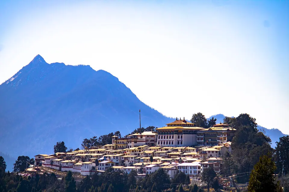
- Tawang Monastery: the destination for most travellers, best seen fresh the next morning.
Our Tawang travel guide covers the town and monastery in detail.
Where to stay either side
There is nowhere to stay at the pass itself. Dirang, at about 1,500 m, is the best night before the crossing because it helps you acclimatise; Bomdila, at about 2,400 m, works if your first day from Guwahati runs short. On the far side, Tawang has the widest choice, from simple guest houses to comfortable hotels with heating. In winter, confirm that your room has a heater or electric blanket.
What to wear and carry
Even in October, the summit wind is bitterly cold. In winter it is serious.
- October to November: thermal top, fleece, windproof jacket, cap and gloves.
- December to March: full thermals, down jacket, waterproof shoes with grip, woollen socks, gloves and a warm hat. Sunglasses for the snow glare.
- Always: sunscreen, lip balm, water, a few snacks and any personal medication.
Our what to pack for Northeast India list covers the rest of the trip.
How we'd plan it
For most travellers, Sela is one morning on a 6–8 night Tawang trip:
- Night before: sleep in Dirang, at about 1,500 m
- 7:00 am: leave Dirang after breakfast
- 9:00–9:30 am: reach Sela summit if the road is open; 30 minutes at the lake
- 10:30 am: Jaswantgarh memorial and tea
- 12:30 pm: Nuranang Falls and lunch at Jang
- 3:00 pm: reach Tawang, rest for the evening
If snow closes the summit, we take the tunnel and try the old road again on the way back. That is how our Tawang with Bum La and Madhuri Lake trip handles it, and couples who want snow and quiet can do the same on our Arunachal Honeymoon. To pair Sela's snow with Kaziranga's rhinos, see Northeast in Winter.
Send us your dates through our contact page and we will tell you what Sela is likely to look like that week.